Details
Product introduction:
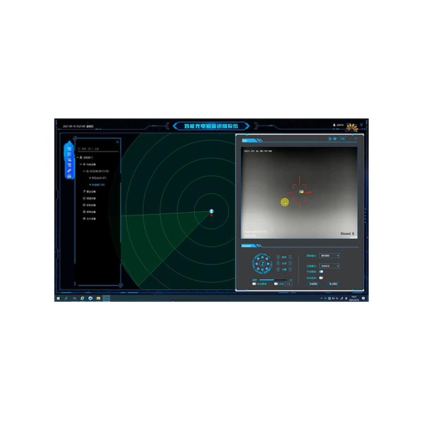
RGS1000 Anti-UAV Intelligent Defense Software (hereinafter referred to as RGS1000) is a comprehensive visual anti-UAV system that integrates user management, video surveillance, target positioning, radar equipment management, spectrum equipment management, optoelectronic equipment management, and countermeasure equipment control. The system combines video technology, intelligent detection technology, signal interference technology, network communication technology, deep learning technology and software platform technology to achieve comprehensive detection, tracking, identification and safety of large-scale, long-distance, multi-target UAVs Reliable interception. It can conduct all-weather and multi-method automatic monitoring of the flight conditions of UAVs in the system's defense area, and conduct real-time reporting and accurate positioning and tracking of suspected targets. secondary damage to achieve safe interception. It can meet the anti-drone security needs in prisons, airports, large-scale events and other scenarios.
The system can fully support and popular photoelectric turntable and photoelectric PTZ equipment with tracking function. Such equipment usually has visible light and thermal imaging dual-channel, and has target tracking function, azimuth field of view angle, tracking missed target amount and status return. Function.
Features:
1) Multi-mode unattended: support unattended in warning zone mode, unattended in photoelectric automatic cruise mode and unattended in lightning guidance mode;
2) Multi-dimensional perception target: support radar, spectrum, identification algorithm and other methods to detect UAV targets; support the integration of multi-dimensional composite perception UAV target technologies;
3) Multi-technical strike defense: support the defense function of adopting multiple technical means for UAVs; support counter-guns, inducing equipment to interfere, suppress and deceive full-band radio signals and GPS signals;
4) Lightning wave data fusion: support radar and spectrum detection data information composite filtering to display UAV targets; support photoelectric analysis target data and lightning wave fusion information in-depth fusion;
5) Linkage of front-end and back-end algorithms: Support the technology of linking the front-end and back-end algorithms to review the target information of UAVs; support the low-computing chip algorithm in the front-end to initially detect the target, and the back-end high-computing service to accurately identify the target of the drone and automatically track the target ;
6) Intelligent algorithm: support visible light/thermal imaging video for target detection and automatic tracking of low-altitude aircraft/airborne objects; support to enhance the accuracy of system alarms through target recognition algorithms; support target intrusion detection in the area, photoelectric tracking target tracking Function: Support photoelectric cruise target detection, detection target follow-up tracking, automatic zoom assist identification, target identification assist tracking functions;
7) High-definition offline map: support high-definition offline two-dimensional electronic map, two-dimensional satellite map, three-dimensional satellite map; support photoelectric, radar, spectrum, counter-induction, custom layer area, target point track, target track, etc. Class information is based on the comprehensive situation distribution display of 2D/3D maps; supports video pop-up window observation and cloud mirror function scheduling of optoelectronic devices; supports map anti-control optoelectronic devices, target track guidance optoelectronic observation and sighting;
8) Extended peripheral access: Supports the access of different manufacturers and different types of equipment such as radar, spectrum, countermeasures, and induction; supports the access of equipment of custom standard protocols, and the extended access of private protocols of new equipment.
Application scenarios:
It is widely used in UAV defense in various industries such as airports, prisons, nuclear, biological and chemical bases, electric power, oil depots, water conservancy projects, and large squares.